Soil datasets and reports
If you have enjoyed using the Soil-Net website, you may be interested in finding out more about the soils where you live. There are several important resources offered by Cranfield University that you can try if you have not done so already.
Welcome to LandIS
Cranfield University's Environment Centre maintains an extensive geographic database of land related data known as the Land Information System, LandIS.
If you are interested about finding out more about the soils of England and Wales, or obtaining digital datasets, maps, books and publications about soils, then do visit http://www.landis.org.uk.
Download extensive open soil datasdets from the LandIS Open Soils Data Portal, visit https://portal.landis.org.uk.
LandIS is operated by Cranfield University, UK on behalf of Defra and is a central repository and information bank about a huge range of soil and soil-related datasets and information; the largest of its kind in Europe.
LandIS has three particular services which may be of interest to you:
 | Soilscapes Viewer is a free web-based mapping system that allows you to enter a location by Postcode or map grid reference to produce a summary of the soils for that area. |
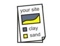 | Soils Site Reporter provides a comprehensive environmental report covering a wide range of soil-related maps, facts and illustrations for a given map location or Postcode for a small fee, payable by credit card. Your first report, however, is completely free if you use the special Soil-Net voucher code '67394165-127' when at the checkout. |
 | You can also lease GIS and tabular datasets on soils and soil properties from Cranfield's Land Information System (LandIS) team. |

A key resource related to Soil-Net is the World Soil Survey Archive and Catalogue, or WOSSAC. The WOSSAC project revolves around a concern apparent for many years that the huge wealth of information and literature collected over the previous 50-60 years by soil scientists around the world is in great danger of being lost and dispersed and sadly even destroyed as companies and governments change and as individuals retire. The archive and catalogue was therefore established by Cranfield University, together with the initial help of the British Society of Soil Science, to draw together all these materials.  We are now holding many thousands of maps, reports, books, field books, survey reports, land assessments, satellite imagery, GIS datasets, photographs (the related SoilPIC collection) etc. in the carefully managed storage facility. The initial goal (with advice from the British Library and Cranfield's own University library) has been to create a catalogue of these items according to international standards (MARC21, Dublin Core, ISO19115) and to make this catalogue available over the Internet - a significant task. Please have a look!